The fourth installment in our Map of the Month series…
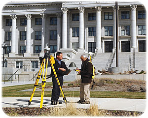
 Precision location is a big business in Utah that includes surveying, construction, transportation, agriculture, and mapping uses. To do precision location efficiently in Utah, you need 3 things: 1) a mapping or survey grade GPS device, 2) a subscription to The Utah Reference Network for GPS (TURN GPS), and 3) a mobile broadband data plan, with reception in your work areas, that allows your GPS device to connect to the TURN GPS service.
 TURN GPS is a network of survey grade GPS receivers permanently located across Utah. The network consists of a partnership of cities, counties and state agencies that contribute equipment and facilities, plus a central solution server maintained by the State’s Automated Geographic Reference Center (AGRC). Analysis and communication of the data sent from over 60 base stations across Utah to the central server allows for filtering of atmospheric distortion to the GPS signals, as they are relayed from orbiting satellites to the end user. All of this happens in real time. The result is a much higher level of precision for GPS receivers in the field.
Users of the network include professional surveyors and field mapping technicians in many different sectors. TURN GPS improves the economics of many activities as it allows for vast improvement of surveying efficiency (eliminating the need to establish local base control), the operation of grading equipment without continual re-staking, and the control of tractors and other implements for precision agriculture.
Because mobile broadband coverage is so important to this process, the July installment of our Map of the Month examines the current footprint of the TURN GPS network with the major wireless broadband providers (AT&T, Leap, Sprint, Strata, T-Mobile, and Verizon). The maps show the strengths and weaknesses of both TURN GPS and the mobile provider networks, allowing TURN GPS users to best prepare for work before heading into the field.
In much of the state, TURN GPS users using survey-grade devices can expect measurement precision of less than or equal to 2 centimeters. This is virtually assured when the three closest TURN GPS base stations are less than 70-80 kilometers apart. Differences in precision expectations are just as important to users as broadband availability and both are shown on the maps. Mapping grade GPS devices have similar precision reliability expectations to their more expensive survey grade cousins, but due to a cheaper GPS chipset and antennae, their best precision is approximately 10 centimeters when connected to the TURN GPS service. By comparison, recreational grade (made by Garmin, Tom-Tom, etc) and smart phone-based GPS equipment, while not supported by TURN GPS at this time, can achieve precisions of around 5 meters.
TURN GPS provides a complete Global Navigation Satellite System (GNSS) solution that utilizes many satellite constellations including USA GPS, Russian GLONASS and the UK Galileo Satellites. Utah is known for its diverse terrain with high mountains, deep canyons and, in some areas, vast tree canopies that challenge GPS users. However, with access to satellites in multiple constellations and the ever-increasing expansion of broadband connectivity, the reach and benefits of this precision measurement technology is on a fast-growth trajectory.
The cost of obtaining centimeter-precise locations in the field used to be measured in hours, if not days. Now it takes just a few seconds across much of our state.
For more information, contact Sean Fernandez (801-209-9359) at AGRC.
